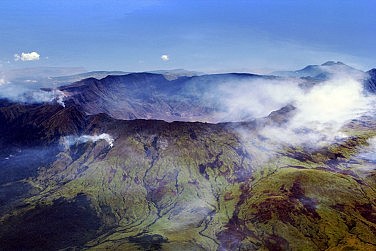
Gunung Tambora photographed
from the International Space Station in 2009. (Photo: NASA Earth Observatory)
Rumbling may or may not portend a massive eruption
on the scale of a century. Fortunately the probability this time is for great
disruption to air traffic, tourism, and the local economy, rather than massive
death and homelessness.
But among the constant eruptions of Indonesia’s
many volcanoes (66 currently being monitored, with 50–60 more considered “active”), huge ones
will come. They will be enormously destructive to Indonesia, will impact the
world’s climate, and will challenge Australia’s capacity to manage without air
traffic while assisting millions of displaced Indonesians to survive and
recover. Even the moderate ones that are likely to occur every decade, causing
dislocations to hundreds of thousands, need to be prepared for in a systematic
way.
The
ring of fire
The truth is that the chain of volcanoes in the
Sunda Islands of Indonesia, from Sumatra through Java and Bali to Timor,
constitutes the most dangerous of the world’s tectonic interfaces [see map
below]. The northward-moving Australian plate thrusts under this chain at a
rate of about 6cm a year, gradually curling downward the southern coasts of the
Sunda chain until that pressure is released as the outer coast springs back
upward. This causes a massive earthquake in each sector, or subduction zone, as
the outer crust of the plate springs up by as much as 5 metres. The 9.2
magnitude quake of December 2004 at the northwestern end of this chain was the
wakeup call. It triggered the “Indian Ocean” tsunami that killed nearly 200,000
people in Sumatra and thousands more around that ocean’s shores.
The geologists went seriously to work on Sumatra
after this crisis, and have now demonstrated a 7,000 year series of previous
mega-events generating tsunamis, occurring irregularly but on an average once in 450 years. Nobody
has done this kind of sophisticated geoscience elsewhere in Indonesia, and less
still in the Nicobars—the other centre of the 2004 quake—where an
over-sensitive Indian government has continued to exclude foreign aid workers
and researchers. But the existing historical record makes clear that events at
least as big have occurred repeatedly along this chain and as far as the
Solomons. The great naturalist Rumphius survived a tsunami in Ambon in 1674
that may have been the world’s highest wave ever described, at around 100
metres.
How does this pattern of subduction and release at
the world’s most dangerous tectonic interface affect the eruption of the
volcanoes that are its most spectacularly visible demonstration? So far, the
science has to say, “it’s very complicated”. The periodicity of mega-eruptions
is one of the great unknowns. But Indonesia has such a major share of the
world’s dangerous volcanoes that recurrence somewhere is inevitable.
|
Table 1. Direct and longer-term deaths from
modern SE Asian eruptions
|
||||
|
Year
|
Volcano
|
VEI
|
Deaths: direct
|
Long term
estimate
|
|
1991
|
Pinatubo (Luzon)
|
5
|
700
|
|
|
1963
|
Agung (Bali)
|
5
|
1,580
|
>50,000 (see
below)
|
|
1919
|
Kelud (East
Java)
|
4?
|
5,110
|
120,000
|
|
1883
|
Krakatau (Sunda
Strait)
|
6
|
30,000
|
>100,000
|
|
1822
|
Galunggang (West
Java)
|
5
|
>4,000
|
?
|
|
1815
|
Tambora
(Sumbawa)
|
7
|
11,000
|
>100,000
|
The VEI of Table 1 refers to the logarithmic
Volcanic Explosivity Index, whereby a mighty 7 (like Tambora) throws out over
100km3 of volcanic material, 10 times that of a VEI 6 (like
Krakatau) which in turn ejects 10 times more than a 5 (like Gunung Agung in
1963).
Perhaps it may be comforting for those awaiting
catastrophe in Bali that the biggest explosive eruptions we know much about,
Tambora in 1815 and Krakatau in 1883, appear to have occurred where there was
not a prior record of regular eruptions every decade or two, or even the three
in two centuries (1808, 1843, 1963) we know for Agung. Merapi, clearly visible
from Yogyakarta and Surakarta and central to the mythology of these traditional
Javanese capitals, is the best-known example of a “manageable” volcano with
frequent eruptions. It has sent lava flows down the mountain towards the cities
every decade or so, without killing more than a few hundred unlucky souls or
displacing more than a few thousand. Kelut and Galunggang have been a little
less frequent but more murderous, whereas Tambora had no known precedents.
The
1963 Agung eruption
The precedent everybody in Bali is very well aware
of is Mount Agung’s eruption of 1963, which occurred at an exceptionally
traumatic time for Bali. The economy was close to a century-long nadir as a
result of the prolonged crisis of Indonesia’s transition to independence and
Sukarno’s confronting, rather than encouraging, foreign investment and aid.
Political polarisation was intense. The Left in Bali saw destruction of the
privileges of the upper-caste triwangsa and the remaining influence of
the island’s rajas as a necessary part of Indonesia’s unfinished revolution.
Traditionalists believed that would mean the end of Bali’s unique civilisation.
The priests decided they needed to cleanse Bali through a massive Eka Dasa
Rudra ritual, last held in the nineteenth century. Though designed specifically
to appease the powerful spiritual forces of the volcano, it failed spectacularly
to do so. Many of those engaged in making offerings at the crater were among
those killed as it erupted.
The series of eruptions, most severe on 17 March
and 16 May 1963, left Bali in misery. Some 1,580 people were reported killed by
the rapid lava flows and accompanying poisonous gases. If a comparable eruption
occurred tomorrow, the death toll would be greatly lessened by the warning
systems now in place and the much better communication and support systems to
get people out. The most impressive example of a major Southeast Asian eruption
where the immediate deaths were relatively few was Pinatubo, close to
population centres in Luzon, Philippines. Some 100,000 were successfully
evacuated before the eruption, the worst in our region in the past half-century.
Pinatubo cooperated with the geologists by gradually increasing the intensity
of its rumbling, making the warnings believable to an always reluctant-to-move
population.
Bali in 1963 was in no such state. Nor did it have
the resources or organisation to cope with the terrible aftermath. Sukarno,
embarking on his “Confrontation” of Malaysia, sought no international aid and
discouraged publicity. The eruptions were estimated to have destroyed some
50,000 to 62,000 hectares of farmland, a fifth of which was irrigated riceland
which had supported over 100,000 people. Livestock were decimated, with 3,467
cattle and 5,858 pigs lost, the basis of many livelihoods in worst-hit
Karangasem. Governor Suteja said in April that, “We have to feed 85,000
refugees and we simply do not have the food to do it.” Reports of malnutrition
and death from starvation became widespread in the local press, though downplayed in national media
wanting to show Bali as harmonious.
How great the longer-term effect of this
destruction of livelihoods was on Bali’s population is difficult to assess. In
earlier times, destruction of agriculture in this intensive rice-growing area
meant death by starvation, unless escaping through bondage to some less
devastated place. Bali in 1963 did in principle have a country behind it, but
the circumstances of the time meant little aid was forthcoming.
The best way to calculate the 1963 eruption’s
effect on Bali’s population should be the two national censuses of 1961 and
1971, Indonesia’s first as an independent country. These have many
shortcomings, but do provide the broad outlines. Indonesia’s population as a
whole grew by 2.08% per annum between the two censuses, whereas Bali’s
population grew by only 0.75%. There was therefore a “missing” population of
67,000 that would have been expected if Bali was more “normal” in this period.
|
Table 2. Missing population (thousands) in three
easternmost districts (kabupaten)
|
|||
|
Kabupaten
|
1961 census
|
1971 census
|
“missing”
between censuses
|
|
Karangasem
|
261
|
267
|
53
|
|
Bangli
|
124
|
138
|
14
|
|
Klungkung
|
128
|
139
|
18
|
|
ALL BALI
|
1,783
|
2,120
|
67
|
|
I am grateful
for the assistance of demographer Hasnani Rangkuty for her work on this
census data.
|
|||
The situation was complicated by a second
phenomenon between the two censuses that may have made Bali abnormal. The
political killings of communists and other leftists in 1965–6 are also thought
to have impacted Bali more than Indonesia as a whole. Though nobody knows the
numbers, estimates as high as 100,000 have become current for the number of
victims in Bali.
The regional dispersion of the “missing” population
at the 1971 census data appears to show, however, that the eruption of Agung
was a much bigger factor. All the loss of normal population growth was in the
eastern kabupaten of Karangasem (the site of the volcano) and its
neighbours Bangli and Klungkung. On the other hand, the massacre of Leftists
was understood to be mainly in the west of the island. The three districts of
Jembrana, Buleleng, and Gianyar were all headed by bupati (regents) from
the PKI (the Indonesian Communist Party) or its ally Partindo, and leftist
activism had been concentrated there. In these western districts population
growth between 1961 and 1971 was above the Bali average.
Population flight from east to west after the
eruption may have masked the demographic effect of killings in the west to some
extent. Nevertheless the eruption was a much bigger factor in Bali’s excess mortality
in the 1960s than has been acknowledged.
Bigger
eruptions will come
The twentieth century, when seismography and
tectonic theory began to make possible a modern scientific understanding of
earthquakes and eruptions, was a relatively “mild” one for Indonesia
geologically. The twenty-first century has in its first decade already far
exceeded the number of casualties from geological disasters in the whole
twentieth century. In the nineteenth, the two eruptions of Tambora (1815) and
Krakatau (1883) both far exceeded anything known in the twentieth.
In that “mild” century Indonesia’s population grew
five-fold from 40 to 205 million, despite one of the world’s more successful
birth control policies after 1970. When population data began to be
systematically collected around 1820, Indonesia’s population was strikingly low
in comparison with India, China, Japan or Europe. This was despite having among
the more benign climates and most fertile soils in the world, and a population
history going back tens of thousands of years. Bali, with an estimated 600,000
people in 1600, appeared to have grown hardly at all by 1820. The reality, it
now appears, is that Indonesia’s population growth must have been very uneven,
with high growth in many periods interrupted not only by wars, but also by
effects on agriculture of massive eruptions like that of Tambora.
Only recently have the dots been connected to show
the major effects of Tambora’s 1815 eruption on world climate. A “year without
summer” followed the eruption in the northern hemisphere in 1816, with crop
failures and famines in Europe, North America, and China. Tambora’s effects on
our own region are far less well known.
The indigenous population of northern Australia,
who must have heard the explosion and seen some of the ash effects, were not
taking notes. We do know, however, that the ash—which fell not only on Sumbawa
itself but the neighbouring islands to the west, Lombok and Bali—caused the
destruction of agriculture in the year that followed, and a massive loss of
population. A Dutch observer counted 34 corpses of people trying to escape
starvation along a 25km stretch of track between Badung and Gianyar in 1818.
Bali exported nothing in the decade that followed except slaves, desperate to
escape starvation by selling themselves to the slave traders. Yet 25 years
later it was restored and flourishing with the beneficial fertilising effects
of the ash fall, exporting large amounts of rice to Singapore and elsewhere.
Only in 2013 were the scientific and historical dots joined
to show that the source of another huge disruption of global climate in 1258
was caused by a massive eruption on Bali’s neighbour to the east, Lombok, the
previous year. This was another VEI 7, with greater emissions than Tambora, and
therefore something the contemporary world of scientific measurement has not
yet had to deal with directly. Although the effects on the northern hemisphere
have again been traced with far greater care than those in our own
neighbourhood, it seems clear that Bali experienced another devastation from
this closer eruption. There is a significant thirteenth century gap in the
Balinese dated inscriptions that are the most reliable means of historical
dating. Balinese and Lombok chronicles of later date suggest that a nascent
Lombok civilisation was destroyed about this time, and that Bali was at such a
low ebb that the first of the series of colonisations from Java’s Majapahit (on
various readings dated 1262 or 1284) encountered little resistance.
How
will the future differ from the past?
Today the populations exposed to the effects of any
repetition of a Tambora-sized eruption have increased many-fold, and become
about 50% urban. This population is no longer directly dependent on its own
crops for survival. Trade and aid should spare the immediately affected region
from famine resulting from the destruction of local crops. Governments today
believe it is their responsibility to ensure the survival of populations so
threatened, and to a great extent have the resources to do so. As the 2004
tsunami disaster showed, the world is capable of great generosity in
contributing to the process of disaster relief and reconstruction, especially
in a place like Bali that is familiar to the world’s tourists.
Tourism to Bali had begun in the 1920s, but only a
tiny handful of mostly Jakarta-based visitors were coming at the time of the
1963 eruption. Bali’s international airport was not opened until 1968, after
which the mass traffic built up to the four million a year who visit today.
This vast expansion will be fundamentally positive in helping Bali to respond
to a really major eruption. Bali’s infrastructure is now exceptionally good,
and the thousands of hotels could be turned to emergency purposes when foreign
tourists stopped coming. International sympathy and media attention could be
expected to be good for Bali, and one hopes that would serve as a stimulus for
aid organisations to assist the exceptionally under-developed and vulnerable
islands to its east—Sumbawa, Flores, and Timor.
On the other hand, the disruption to air traffic in
a major eruption of the scale of Tambora or even Krakatau would be
unprecedented. Only in the era of jet engines has this become a serious
problem, when only eruptions of VEI 5 (Pinatubo)—or more often 2, 3 or 4—have had
to be dealt with.
Although the density of flights in Europe ensured
that Iceland’s Eyjafjallajökull (2010) caused the greatest cancellation of
flights so far, it is our region that has caused the greatest damage to planes.
Only when two 747s lost engine power flying into the ash thrown out by Mount
Galunggung in West Java in 1982—one of them narrowly averting a crash after
losing all four engines—was the aviation world spurred into serious action.
In the 1990s a system of reporting activity and
advising pilots was gradually put in place. The world has been divided into
nine regions, each monitored by a Volcanic Ash Advisory Centre (VAAC). Our
region, including the dangerous volcanic arc from Sumatra to the Solomons, is monitored by the VAAC Darwin.
Insurance companies have ensured that airlines heeded their advice. In the last
decade, as travellers to Bali have been painfully aware, warnings from VAAC
Darwin have caused flights between Australia and Indonesia to be grounded with
unprecedented frequency on account of the following moderate Indonesian
eruptions:
- Sangeang Api (Sumbawa), May 2014
- Kelut (East Java), November 2014. Two engines
were damaged beyond repair in one Jetstar flight which did not hear the
warning, though the flight was completed.
- Raung (East Java), July–August 2015 (twice)
- Rinjani (Lombok), November 2015 to August
2016, (three times).
Nobody knows what the effect of a repetition of a
Tambora-scale eruption would be on today’s jet-dependent world. One hopes that
some fraction of the large defence budgets of Australia and Singapore are being
devoted to modelling and preparing for the appropriate response to a major
disaster far more likely (indeed certain, in a longer time frame) than a
repetition of the past military threats that have fed outdated military
insecurities. Cooperation between military and emergency services in these two
rich countries and under-resourced Indonesia, Papua New Guinea, and East Timor
must begin before the disaster occurs, to establish trust, communication lines,
and strategies. This kind of military and strategic engagement between
neighbours has no down side in threatening others. It should be the minimum we
ask of our governments.
…………………………
Emeritus Professor Anthony Reid is a historian of Southeast Asia based
at the Australian National University, to which he returned after served as
founding Director of the Asia Research Institute at the National University of
Singapore (2002–7) and founding Director of the Centre for Southeast Asian
Studies at the University of California, Los Angeles (1999–2001).
No comments:
Post a Comment